
The Challenge of Underground Localization for Emergency Services
When an emergency strikes underground—in a tunnel, mine, or parking garage—first responders face a critical obstacle: the absence of GNSS signals. Satellite navigation systems (GNSS) simply can’t penetrate dense materials like concrete or rock. The result? Firefighters and rescue teams are left without reliable positioning data. This lack of visibility delays victim care and increases risks for responders operating in complex, unfamiliar environments.
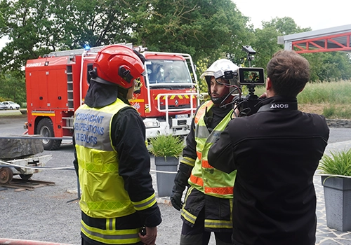
The SDMIS of Lyon, known for its expertise in deep confined-space operations, identified this operational gap. In partnership with Syntony GNSS and CS-Group, they produced a demonstration video of the SubWAVE™ system at La Mine Bleue, a tourist site near Angers. The goal: to showcase how real-time GNSS signal emulation can enhance safety and efficiency in underground rescue missions.
SubWAVE™: Simulating GNSS Signals Underground
At the heart of this innovation is SubWAVE™, a solution developed by Syntony GNSS. Unlike GPS repeaters, which merely retransmit surface signals underground, SubWAVE™ generates realistic GNSS signals in real time, including altitude data tailored to different underground layers. These signals are fully compatible with standard GNSS-enabled devices—whether professional radios or everyday smartphones.
SubWAVE™ broadcasts these signals through antennas or existing underground radio infrastructure, ensuring a seamless transition between surface and subterranean environments. This means responders can be continuously tracked without needing specialized gear or recalibration.
In the demo video, the system’s effectiveness is clear: firefighters equipped with radios or using the RRF (Réseau Radio du Futur) are tracked in real time, enabling command centers to coordinate operations with unprecedented reliability.
Expanding the Horizon: From Victim Detection to AI Integration
Thanks to GNSS coverage and responder localization underground, a wide range of advancements becomes possible:
- Locate victims or lone workers, even without active signal transmission, by leveraging GNSS capabilities in mobile phones.
- Integrate guidance and alert systems into helmets or masks for first responders.
- Use AI to map and analyze intervention zones, anticipate hazards, and enhance situational awareness.
- Enable interoperability between emergency services (fire, police, EMS) through shared geolocation data.
- Extend localization to complex indoor environments (shopping malls, high-rise buildings) where GPS often fails.
These aren’t just technical upgrades—they represent a paradigm shift in how emergency services operate in GNSS-denied zones. By embedding intelligence and connectivity throughout the response chain, SubWAVE™ is redefining safety and coordination standards.
See SDMIS’s communication on LinkedIn
Learn more about SubWAVE™ or contact Syntony here